Using the measurement tool allows you to generate records of length, area, or volume.
You can use Unearth’s measurement tool to get a linear or area measurement on any project, in any location. If you’ve uploaded a drone survey, you can get the volume for any area that you outline too. Here’s how you do it:
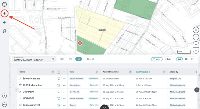
- Click on the plus button in your taskbar on the left of your screen.
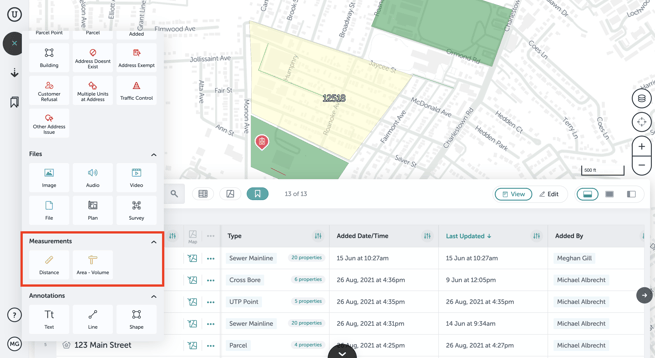
- Find the section that contains the measurement type of assets. This may be labeled “Measurements”. Click on the type of measurement you want to add.
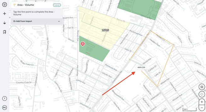
- Click on the map where you want to start your linear or area/volume measurement. Click at each point where you want the line or outline of the area to bend. To end a line measurement, click on the last point twice. To close the outline of an area/volume measurement, click on the first point you placed on the map.
- In the measurement’s form, you can edit or add information about the measurement. Once you’ve done so, or if you don’t plan to do so, you can click "Done" in the lower right of the form.
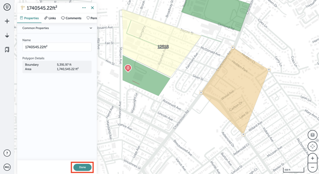
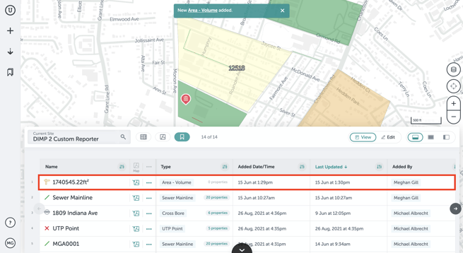
- You’ll then see the measurement in Table View and on the map.
If you run into any issues or have any questions, please reach out to us at support@unearthlabs.com.
Revised June 2022