Data Cleaning for Multiple Asset Types Using QGIS
If the data file being used for your project has multiple asset types (points, lines, and/or polygons), use this guide to clean the file prior to importing into Unearth.
First, download QGIS. We recommend the long-term release version as it is the most reliable. Please visit QGIS's User Guide for more detailed help articles if needed.- Open QGIS and have the GIS file(s) you'd like to clean ready. Drag and drop the GIS file(s) into QGIS.
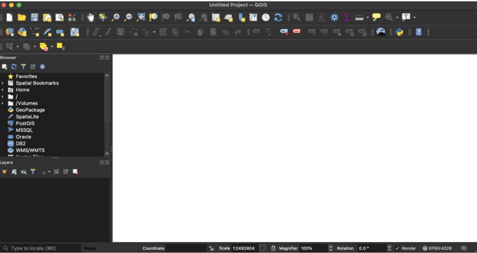
- You will be asked to select the files you want to import and the CRS (Coordinate Reference System) - select the first CRS option.
- Once the file(s) have been uploaded, make sure the CRS of the map is "WGS 84 EPSG:4326." It should look like this:

- If you do not see EPSG:4326, click on the coordinate globe. Then, in the next window, use the search bar and search WGS 84, then locate and select "WGS 84 EPSG:4326." Click "OK" to continue.
- Now your data will be ready to export in a format that will work in Unearth!
- When you imported the original GIS file, you will see how many separate asset types there are (i.e., sanitary lines, sanitary manholes, etc.). To correctly import these into Unearth, we need to break out each of these asset types.
- Navigate to the left side of the window and locate the list of asset types under the "Layers" list.
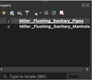
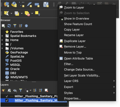
- For point assets or single-type line assets: Click to select an asset type - it will turn blue when selected. Right click on the selected asset and select "Export."
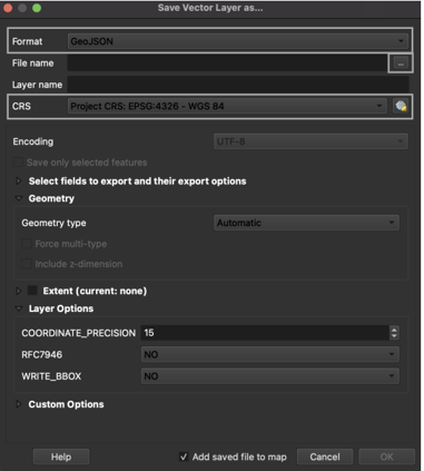
- Save the file, ensuring it is being saved as a GeoJSON (Unearth's preferred filetype) and that you are saving it in an accessible location. Click on the 3 dots to open where you would like to save the file on your local device. The CRS should be EPSG:4326 - WGS 84.
- Save the file, ensuring it is being saved as a GeoJSON (Unearth's preferred filetype) and that you are saving it in an accessible location. Click on the 3 dots to open where you would like to save the file on your local device. The CRS should be EPSG:4326 - WGS 84.
- For multi-type line assets: To export the line asset type, you MAY need to divide the file into two separate files (mainline and laterals, for instance, if needed). If there is only one asset type, follow the previous section step 2. If there are two or more asset types in one layer or file, follow these steps:
- To create individual line files, such as a mainline or lateral only file, locate the selector tool:
 Click on the dropdown arrow and select "Select Feature(s)."
 - Locate the correct line type such as mainlines and click on the asset to highlight/select it. Hold command (Mac) or control (PC) to select multiple mainlines at once.
- Once all the mainlines have been selected, right-click on the asset type name (bottom left on the screen). Select "Export," then "Save Selected Features As," and follow the steps in step 2i.
- If there are any other line asset types you need to separate, follow the same steps in step C for each one.
- To create individual line files, such as a mainline or lateral only file, locate the selector tool:
- Navigate to the left side of the window and locate the list of asset types under the "Layers" list.
Now that your data is cleaned into the correct file type and individual assets, follow the first part of this article to import the assets into Unearth.
If you run into any issues or have any questions, please reach out to us at support@unearthlabs.com.
Revised June 2022