Map layers include project plans, boundaries, drone surveys, and the basemap.
Customization is key to Unearth. Within your project, you can add personal map layers, adjust your project boundaries, view all linked assets, and drone surveys, and you can change the basemap of your project. The "Map Layers" dropdown window compactly groups these features, allowing for quick navigation and use. Here's how to locate the window and what you can do with it:
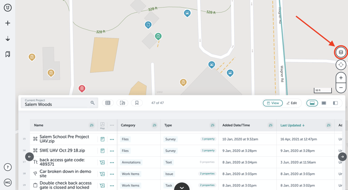
Click on the "Map Layers" button on the right side of your project to open the dropdown window.
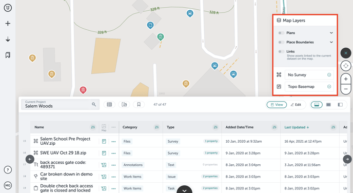
Once you open the window, you'll see individual groups ("Plans," "Place Boundaries," "Links," "UAV Surveys," and "Basemaps"). We'll go through each one of these now:
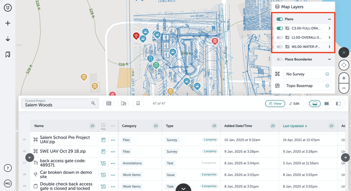
Plans
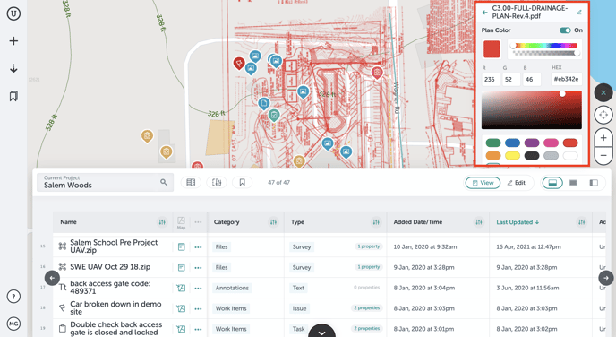
When you upload map layers to your project, they will appear in a list in the "Map Layers" window.
- Click the caret next to "Plans" to view all of the plans that are on your project.
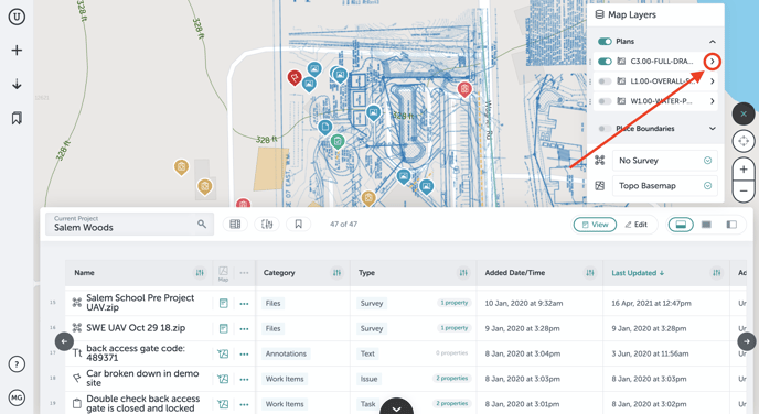
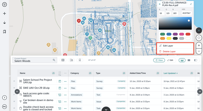
- Here, you can edit the color, position, or delete the layer when you click the caret next to the layer name.
Place Boundaries
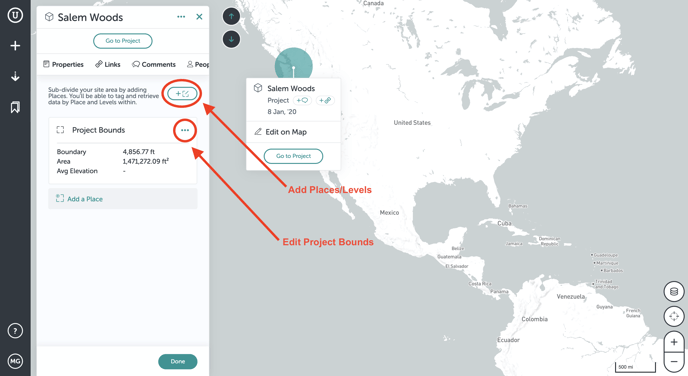
You initially create a project by setting boundaries. In the "Place Boundaries" tab, you can visualize your bounds on your project map. This way you can see what work has been done inside your designated work area. You can also manage places, meaning you can associate certain geographical areas with polygons. This way you can control one larger site that may have smaller, individual projects within it.
- Click on the caret next to "Place Boundaries." This will enable you to toggle on or off site bounds and any place or building bounds.
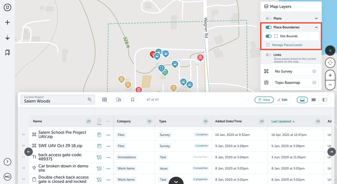
- You can also click on "Manage Places/Levels," which will take you off of your project and allow you to edit or add map levels to the project and edit your project bounds if needed.
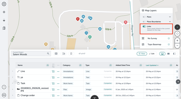
Links
When you apply filters to your project, assets that are not within those filters will not appear on the map. If you want to show assets that are not on the map but are linked to current assets shown, you can toggle on the "Links" switch.
- Toggle on the "Links" switch to view assets linked to current assets shown on the map:
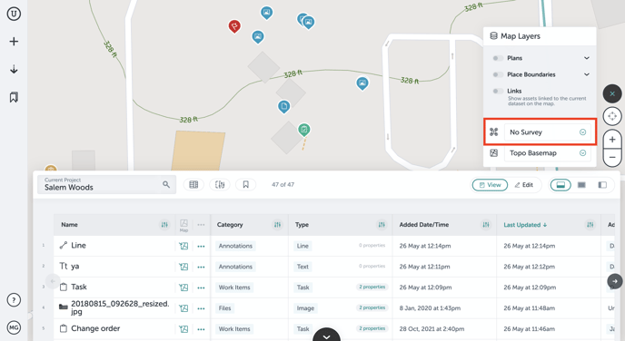
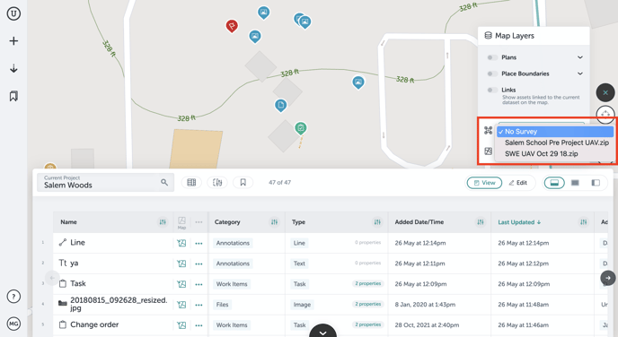
UAV Surveys
In the "Map Layers," you will find all of your uploaded drone surveys. When you click the dropdown, a list of the surveys will appear and you can select which one you'd like to view.
- Click the dropdown caret to view surveys:
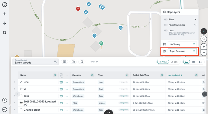
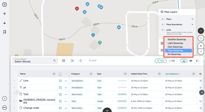
Basemaps
Finally, you have the ability to change your basemap. You have the choice between a satellite, light, dark, topo, or no basemap. The most popular among customers is the topo or the light basemap.
- Click on the basemap dropdown caret to see your options:
If you run into any issues or have any questions, please reach out to us at support@unearthlabs.com.
Revised May 2022